
In land announcements and cadastral documents, land areas are still expressed in hectares, ares, and centiares. This persistence of cadastral units regularly creates confusion when purchasing a plot or planning a construction project. Converting 6 ares into square meters seems simple on paper, but the implications of this figure for a real estate project deserve attention.
Cadastral units and conversion of ares to m2: the exact mechanism
The French cadastre uses three units to express land areas: the hectare (ha), the are (a), and the centiare (ca). The relationship between them follows a strict decimal logic. 1 are equals 100 m2, 1 hectare equals 10,000 m2, and 1 centiare equals 1 m2.
Therefore, converting 6 ares means multiplying 6 by 100. The result is 600 m2. No complex formula, no correction coefficient. However, this simplicity hides a frequent pitfall: on a cadastral survey, a plot may be noted as “0 ha 06 a 00 ca,” which indeed corresponds to 600 m2, but a quick reading of the “06” without identifying the column can sometimes lead to errors by a factor of 100.
To verify the area of 6 ares in m2 of a plot, simply reconstruct the calculation from the three columns ha/a/ca of the cadastral survey, then add the results converted into m2.
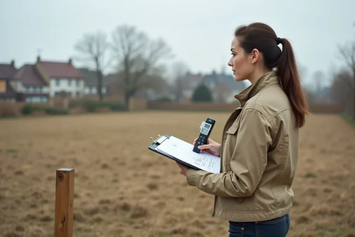
Land of 600 m2: where it stands in the current land market
Data published by the statistical service of the Ministry of Ecological Transition for the period 2019-2022 indicates that the median area of land purchased to build a single-family home is 670 m2. A plot of 600 m2 is therefore slightly below this national median.
This positioning has concrete consequences. A lot of 600 m2 remains compatible with the construction of a single-family home in most municipalities, but the margins for maneuver decrease as soon as the local urban planning plan imposes significant setbacks from property boundaries or public roads.
Placement constraints on a 600 m2 plot
On a plot of this size, the buildable ground area directly depends on the ground area coefficient (CES) set by the PLU. With a CES of 0.30 (a common value in residential areas), the maximum footprint reaches 180 m2, leaving room for a single-story house with a garden. On the other hand, a more restrictive CES or high setback distances can significantly reduce the actual buildable area.
Field feedback varies on this point: depending on the municipalities, the same 600 m2 plot can accommodate a generous construction or be heavily constrained. Consulting the zoning regulations of the PLU before any commitment remains the only way to eliminate this uncertainty.
Calculation of living area and land area: two concepts not to be confused
The confusion between land area and living area often arises in real estate projects. The land area (600 m2 for 6 ares) measures the land parcel, while the living area measures the interior space of the dwelling, excluding walls, partitions, stairs, and rooms with a ceiling height of less than 1.80 meters.
This distinction has direct effects on several aspects of a project:
- The purchase price of the land is negotiated per m2 of land area, while the resale price of a constructed house is primarily calculated based on the living area
- Home insurance takes into account the declared living area to establish the premium, not the land area
- The calculation of property tax includes the cadastral rental value, which depends on both the built area and the characteristics of the plot
A buyer who confuses the two risks overestimating the buildability of a plot or miscalculating the costs associated with their project.

Measurement errors and legal consequences during a sale
In co-ownership, the Carrez law requires the mention of the private area in the sales deed. An error of more than 5% to the detriment of the buyer entitles them to a proportional reduction in price. This rule applies to the area of co-ownership lots, not to vacant land sold outside of co-ownership.
For a plot, cadastral data does not guarantee centimeter-level accuracy. Boundary marking by a surveyor remains the only reliable method to establish the actual area of a plot. On a plot advertised as 6 ares, a discrepancy of a few m2 may seem negligible, but in areas where the price per m2 is high, the financial difference becomes tangible.
Verification before purchase: concrete steps
- Request an up-to-date cadastral survey and reconstruct the area in m2 from the ha/a/ca columns
- Compare with the area indicated in the sales agreement or promise
- Order a contradictory boundary marking if the plot has never been marked or if the physical boundaries (fences, hedges) do not match the cadastral plan
- Check the urban planning certificate to know the applicable building rules for the plot
The cost of boundary marking varies depending on the configuration of the land and the number of markers to be placed, but it represents a marginal fraction of the acquisition price of a buildable plot.
A plot of 6 ares, or 600 m2, falls within a common range for individual construction in France. The conversion itself poses no technical difficulty. What deserves attention is the correct reading of cadastral documents, the verification of local urban planning rules, and the clear distinction between land area and living area. These three points determine the actual feasibility of a project far more than the simple result of a multiplication.